
Last updated: October 2026 · Checked against Highway Code
Quayside Sign: meaning, rules and what to do
The quayside or river bank warning is a red-bordered triangle with a black pictogram of a car beside open water, telling you the carriageway edge may be unprotected, weak, or close to a sudden drop so you should slow, hold your line on the metalled surface, and avoid reversing or parking where wheels could slip into the harbour, river, or canal.
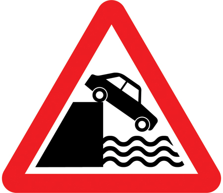
Sign image © Crown copyright, reproduced from GOV.UK traffic sign images under the Open Government Licence v3.0.
What the Quayside or river bank Sign Looks Like
Official GOV.UK artwork uses the standard UK warning frame: upright red triangle, white centre, black symbol. The pictogram shows a side-view car with the nearside wheel close to stylised water, suggesting a quay, river bank, or canal towpath interface rather than a ford you drive through. There are no speed numerals or blue mandatory circles inside the border.
Engineers mount it where the carriageway runs along a harbour arm, estuary wall, flood embankment, or riverside lane with little margin between white line and drop. Posts often sit on the landward verge so drivers see the symbol before the parapet ends or where a rebuilt quay narrowed the lane without moving the centre line.
Distance plates in yards or metres sometimes follow on faster approach roads, especially where holiday traffic queues for ferry terminals. Repeaters may appear after a side junction so traffic joining from a town square still receives the same heads-up before the waterfront straight.
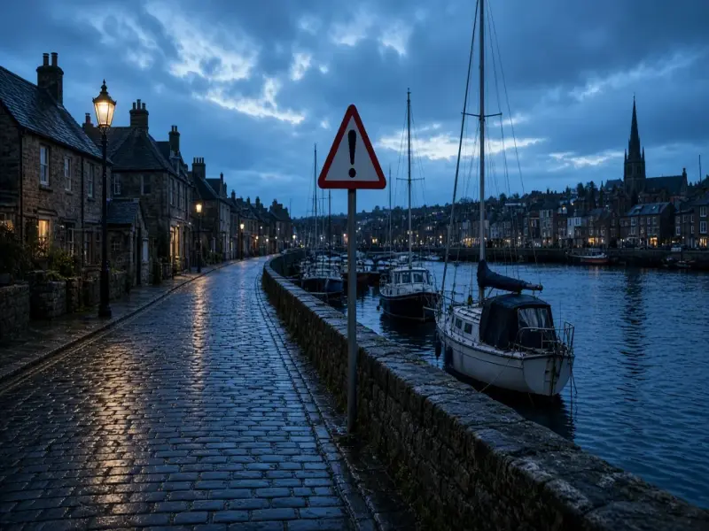
Retroreflective sheeting makes the red rim visible in rain when street lamps reflect off wet cobbles. At night the water itself may be invisible until your beam catches a mooring post or ripple; the triangle is your cue to lift off the throttle before glare hides the kerb.
Learners often confuse it with the ford triangle, which shows a car wading through water on the carriageway, or with the flood word plate that marks liable to flooding along a dip. Soft verges warnings highlight weak grass edges without promising open water. Opening bridge artwork shows a split deck for shipping, not a car teetering at a quay lip.
Temporary barriers after storm damage may narrow the lane further while the permanent sign remains. Treat any consistent quayside pictogram as the same hazard class even when bollards or fencing change the exact width week to week.
Ford warnings describe water you cross on the road surface. Flood plates warn that the lane may submerge. Soft verges highlight edges that may not support wheels on grass or gravel. The quayside triangle is specific to an unprotected or fragile margin beside open water, where a small steering error can become immersion rather than a muddy rut.
What the Quayside Sign Means
Highway authorities install the warning where hydrology, harbour layout, or historic quay design places the travelled way tight against a drop. It does not quote a setback distance or ban parking by itself. It tells you that routine driving beside scenic waterfronts can fail if you treat the edge like a normal kerb, so planning lane position early matters more than on a suburban avenue.
Rule 125 in The Highway Code reminds you that speed limits are maximums in good conditions. A national speed limit on a narrow harbour road may still be far too fast when oncoming vans meet beside mooring cleats and pedestrians step off the pavement without looking. The triangle buys time to choose a safe line before the parapet disappears.
Rule 126 links speed to stopping distance. On wet granite setts your tyres may track unpredictably toward the drop when you brake late. Gentle steering and a steady speed keep load on all four wheels; sharp corrections near a low wall can break grip on slimy stone common on fish quays.
The pictogram implies vertical hazard as well as horizontal squeeze. Tides do not need to be high for the risk to be real: many quays expose sheer faces at low water, and ladders or chains may snag a wheel arch if you mount the edge while reversing into a parking bay.
Meeting traffic on single-carriageway quays demands judgement. Neither driver should assume the other will hug the wall; both should slow and agree space with signals, because there is rarely room to reverse if you stop half astride a bollard line with water behind one mirror.
Pedestrians, anglers, and dock workers often occupy the same narrow strip. Rule 213 expects you to look out for vulnerable road users. Children near railings may lean over to feed birds just as a wide-wing mirror passes; give them room even if you have right of way on the carriageway.
Cyclists may hug the crown to avoid drain covers near the waterline. If you drive, avoid squeezing them toward the drop when overtaking; cross only when you can leave a generous gap and sight lines show no oncoming traffic.
HGVs and coaches on delivery runs to harbours need extra width yet cannot shrink their track. The warning helps car drivers anticipate why a lorry may occupy the centre line even when no white line marks lanes. Patience beats inching past with water on one side and wing mirrors on the other.
Caravans and long trailers amplify rear swing when you turn off a quay into a side street. The sign should prompt a wider approach angle before the rear wheels cut toward the kerb, especially when stone bollards sit flush with the edge.
Electric vehicles carry no special exemption from physics: low centres of gravity help cornering but not recovery if two nearside wheels drop off a lip. Treat immersion as a recovery and insurance nightmare, not a splash you can power through.
Night economy around marinas brings glare from pubs and deck lights. Dip headlights so you can read the nearside line and any reflective posts. Full beam can flatten contrast between stone and black water until it is too late to steer away.
Winter frost on quay roads hides black ice near spray zones. Summer heat is not the only season for caution; harbour mist can reduce visibility below the distance needed to judge oncoming wing mirror clearance.
Read tyre position against the nearside line, not against parked boats or railings that may sit inside the danger zone. If the lane has no line, imagine a metre buffer from the drop and adjust when meeting traffic.
Avoid reversing along unfamiliar quays unless you have a spotter. Cameras help but cannot show submerged steps or slimy algae on the lip. Forward into a bay when possible, or use a car park away from the edge.
Sat navs may route you along a scenic quay to save seconds. When the red triangle appears, trust road furniture over an optimistic ETA, especially when tide times coincide with market-day congestion.
Open car windows near water to hear dock alarms or shouted instructions from harbour staff during vessel movements. Sirens sometimes precede temporary holds on quay traffic while cranes swing loads overhead.
Do not stop on the carriageway for photographs with wheels angled toward the drop. Use signed lay-bys or car parks; blocking the only escape lane forces others to manoeuvre with water at their door.
After storms, check council updates before assuming the quay is open. Waves can undercut edges while the sign still stands. Fresh cracks in tarmac or missing coping stones mean treat the margin as even narrower than the pictogram suggests.
Driving instructors on coastal test routes coach candidates to name the hazard aloud and ease off before cobbles change camber toward the water. Examiners watch for late steering that sends the bonnet toward railings when avoiding a parked van.
If you tow, remember the trailer follows a tighter arc. A hitch that clears the kerb on the way in may still drop rear wheels toward the drop on the way out unless you swing wide early.
Fleet drivers delivering to fish markets should plan arrival before peak auction traffic when forklifts cross the same lip pedestrians use. The warning triangle is the static reminder that dock logistics and public roads share fragile geometry.
Highway Code rules 125, 126 and 213 (speed, stopping distances and vulnerable road users)
Quayside or river bank vs Similar Signs
| Sign | Meaning | Legal or warning? |
|---|---|---|
| Quayside or river bank | Unprotected drop or weak edge beside open water | Warning triangle |
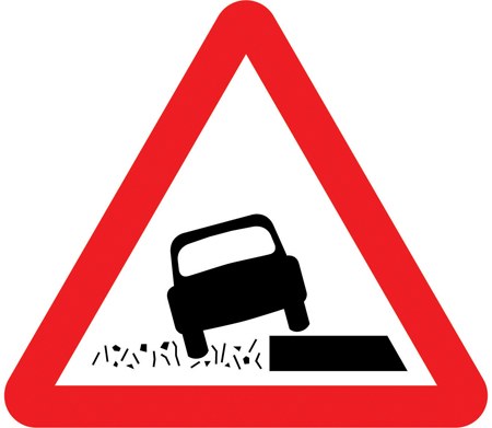 Soft verges | Verge may not support wheels; stay on the carriageway | Warning triangle |
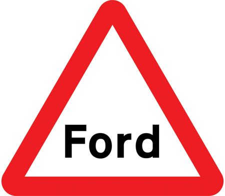 Ford | Shallow water crossing on the road that may deepen | Warning triangle |
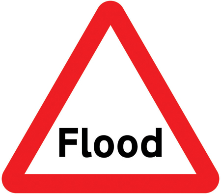 Flood | Road liable to flooding across the surface | Warning triangle |
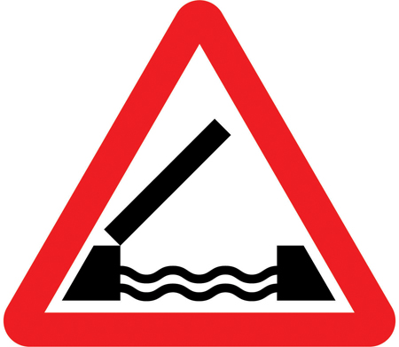 Opening bridge | Movable road span may open for shipping | Warning triangle |
Rules and Penalties
The quayside warning triangle does not create a fixed penalty by itself because it is advisory. Driving without due care if you mount the edge and need rescue can attract police attention, especially when witnesses see you ignore obvious parapet gaps.
Parking with wheels overhanging a quay may breach local harbour by-laws or traffic orders where double yellow lines or signed restrictions apply. The triangle warns; separate plates and lines enforce waiting limits.
Causing obstruction by blocking the only quay road while attempting a multi-point turn can lead to penalty charge notices in some ports, separate from marine safety rules.
Insurance claims after immersion often fail if investigators show reckless positioning beside a signed drop. Recovery from water is expensive; prevention is cheaper than arguing about whether the sign was visible.
Driving tests mark serious faults for poor lane discipline near hazards. Rolling toward railings while passing parked cars suggests you did not act on the warning the triangle represents, even if the examiner never names the plate aloud.
Check the latest theory test pass mark and book when you are ready via our booking guide.
Quayside or river bank in Practice
Marcus drives toward a Cornish harbour on a narrow one-way quay during a summer evening. The quayside warning appears with a plate reading one hundred yards. He cancels adaptive cruise, selects second gear, and checks mirrors for a delivery van tight on his tail.
Cobbles camber gently toward mooring posts where gulls perch. Marcus keeps his nearside wheel inside a faint white line that stops short of a low granite wall. An oncoming hatchback slows; both drivers leave mirror clearance without hugging the drop.
Near the fish shop a family steps from between parked cars. Marcus eases to a walking pace, hands ready on the wheel, and waits until they reach the pavement rather than swerving seaward for a gap that does not exist.
On theory revision he matches the pictogram to unprotected edge beside water, rejecting ford artwork that shows wading depth. In a hazard perception clip he scores by lifting off when brake lights bunch on shiny setts before a waterfront glare, even when the post is out of frame.
His instructor later asks what he would do if a reversing tourist blocked the lane with rear wheels near the lip. Marcus answers that he would hold position on firm carriageway, avoid honking them toward the drop, and wait for a harbour attendant rather than squeezing past with water beside his tyres.
How This Sign Appears on the Theory Test
Picture questions show the car-beside-water pictogram and ask what hazard to expect. Choose unprotected drop or quayside edge, not ford, flood word plate, or opening bridge deck artwork.
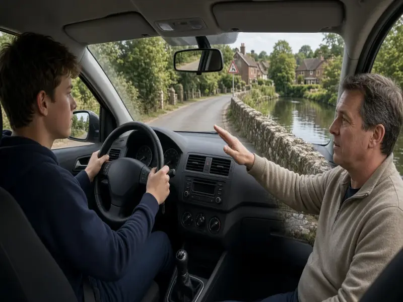
Scenario stems may describe meeting traffic on a narrow harbour road. The safe pattern is slow down, hold your line on the carriageway, and leave space; reject answers that tell you to hug the water for view or reverse blindly toward the drop.
Distractors sometimes show soft verges without water in the symbol. Compare carefully: grass crumbling edges use different artwork from open water beside the wheel line.
Hazard perception rewards early easing off when cobbles shine and queues form before waterfront parking. You may not see the triangle in the clip, but the behaviour it teaches still raises your score.
When revising warning triangles, sketch a car with the nearside wheel beside waves and label it river bank or quay. Examiners expect instant recognition without confusing it with liable to flooding text plates.
Take a free mock theory test and filter questions on road and traffic signs. Pair that with the warning signs guide for triangle symbols.
Related Road Signs
Opening bridge
River crossings where marine traffic interrupts the road deck nearby.
Flood
Low quays and embankments where tide or rain covers the carriageway.
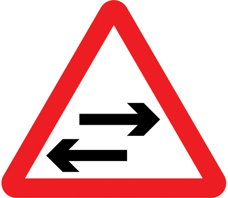
Two-way traffic
Narrow quay roads where oncoming vehicles cannot reverse toward water.
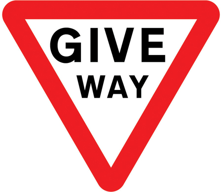
Give way sign
Priority at tight mouths where side roads join the waterfront route.
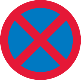
No stopping
Keep-clear lengths on working quays where loading bays need flow.
Test Yourself on UK Road Signs
Let the quayside warning start your routine early: slow before the edge, keep wheels on firm carriageway, and treat meeting traffic as a shared problem rather than a race for the last inch beside the water. Harbour roads reward calm lane discipline more than bold steering. A free mock theory test helps you practise waterfront triangles before the exam swaps ford, flood, and quayside artwork.
Frequently Asked Questions
What does the quayside or river bank warning mean?
It warns that open water lies close to the road edge and the margin may be unprotected or weak. Slow down, stay on the metalled surface, and avoid reversing or parking where wheels could slip into the harbour, river, or canal.
How is this different from the ford sign?
The ford pictogram shows a car driving through shallow water on the road. The quayside pictogram shows water beside the car with no crossing implied. Fords need depth checks; quays need lane position and edge discipline.
Does the warning set a speed limit?
No. It is advisory. You must obey posted limits and drive slowly enough to stop safely and pass oncoming traffic without straying toward the drop.
Should I hug the wall to let traffic pass?
Only if the carriageway width and your line keep all wheels on firm surface with safe clearance from the drop. Never mount a low wall or kerb to make room; both drivers should slow and agree space instead.
Will this appear on my theory test?
Warning triangles are core knowledge. Expect image questions that ask you to identify unprotected water edges and scenarios about narrow quay roads, meeting traffic, and safe lane position.